
Mapping a dense forest comes with its own challenges. Thick tree cover makes it difficult to assess what lies beneath the canopy, while uneven terrain makes surveys harder to carry out. Measuring trees and documenting forest conditions across large areas takes time and effort. For forestry professionals, collecting accurate information without spending excessive time in the field is a constant challenge.
Forest mapping with LiDAR (Light Detection and Ranging) offers a different approach. By capturing forest environments in three dimensions, LiDAR makes it easier to study canopy structure, tree characteristics and terrain. But which scanning approach works best? The answer depends on the survey area, accessibility and level of detail required.
How Does LiDAR Help in Forest Mapping?
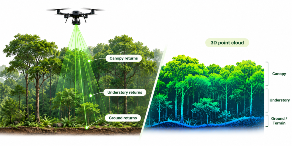
LiDAR uses laser pulses to capture measurements of surrounding objects and generate 3D point clouds. In forestry, these datasets reveal different aspects of the environment:
- Canopy height: Understand the vertical extent of forest vegetation.
- Terrain elevation: Map ground surfaces beneath vegetation.
- Tree structure: Examine trunks, branches and crown dimensions.
- Vegetation distribution: Understand how vegetation is arranged across an area.
Aerial and ground-based scanning offer different views. One captures the forest from above; the other documents details from within it.
Three Approaches to Forest Data Collection
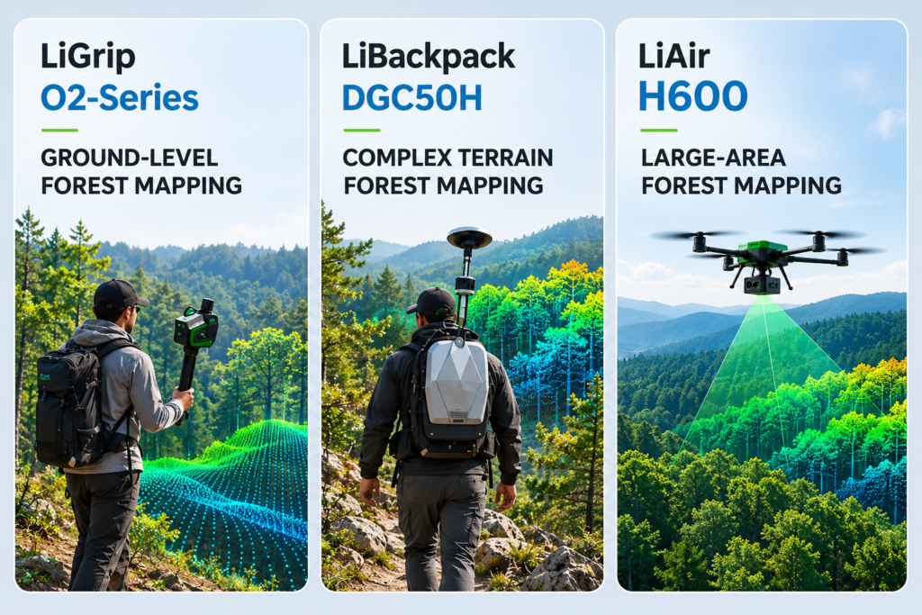
1. Aerial Forest Mapping with LiAir H600
Imagine surveying hundreds of hectares of forest with difficult ground access. Covering the entire area on foot would take considerable time.
UAV-based LiDAR offers a more practical approach. The LiAir H600 captures spatial data from above, making it suitable for large-area forest surveys. Its multi-return capability records reflections from different vegetation layers, helping map canopy structure and terrain.
For survey teams, this aerial approach is particularly useful when assessing extensive forest coverage, creating terrain models and studying canopy distribution.
Suitable applications:
- Large-area forest mapping.
- Canopy structure assessment.
- Terrain modelling.
- Forest resource surveys.
2. Ground-Level Forest Scanning with LiGrip O2
Aerial mapping provides a broad overview, but what happens when the survey requires details of individual trees?
Consider a team surveying a forest plot. Instead of relying entirely on repeated manual measurements, an operator can walk through the area with the LiGrip O2, capturing surrounding trees and vegetation as they move.
The handheld scanner records ground-level structures, including tree trunks, branches and surrounding vegetation. This makes it useful for detailed forest plot surveys and individual tree assessments.
3. Mobile Forest Mapping with LiBackpack DGC50H
Some surveys extend beyond individual plots. They follow forest paths, trails and longer walking routes.
The LiBackpack DGC50H combines LiDAR, GNSS and SLAM technology to capture spatial information while an operator walks through the environment. Its backpack-mounted design allows continuous data collection along accessible routes, documenting vegetation and surrounding terrain along the way.
For projects involving extended walking surveys, this approach offers a practical way to capture ground-level spatial data.
Choosing the Right LiDAR Setup
The right equipment depends on the survey objectives and the type of information required.| Scanning System | Perspective | Suitable Applications |
|---|---|---|
| LiAir H600 | Aerial | Large-area mapping and canopy assessment |
| LiGrip O2 | Handheld | Detailed tree and forest plot scanning |
| LiBackpack DGC50H / LiGrip O2 Backpack Kit | Backpack-mounted | Mobile forest mapping, forest trails and ground-level vegetation surveys |
From Point Clouds to Forest Inventory with LiDAR360
Capturing data is only part of the survey. The next step is turning point clouds into useful information. LiDAR360 provides forestry analysis tools for:- Individual tree segmentation.
- Tree height and crown diameter extraction.
- Diameter at Breast Height (DBH) estimation.
- Forest structure analysis.
Combining Aerial and Ground LiDAR for Complete Forest Mapping
No single scanning approach captures every aspect of a forest. Aerial LiDAR documents broader canopy and terrain patterns, while handheld and backpack-mounted systems add details from ground level. Processing these datasets brings the different views together.
For forest departments, plantation owners, researchers and organisations involved in carbon-related projects, this combination creates a stronger foundation for forest inventory, assessment and monitoring.
Mirai Aerospace brings together aerial and ground-based LiDAR solutions, supported by LiDAR360 software, for different forest mapping requirements.
Share your survey needs. Find your setup with Mirai.